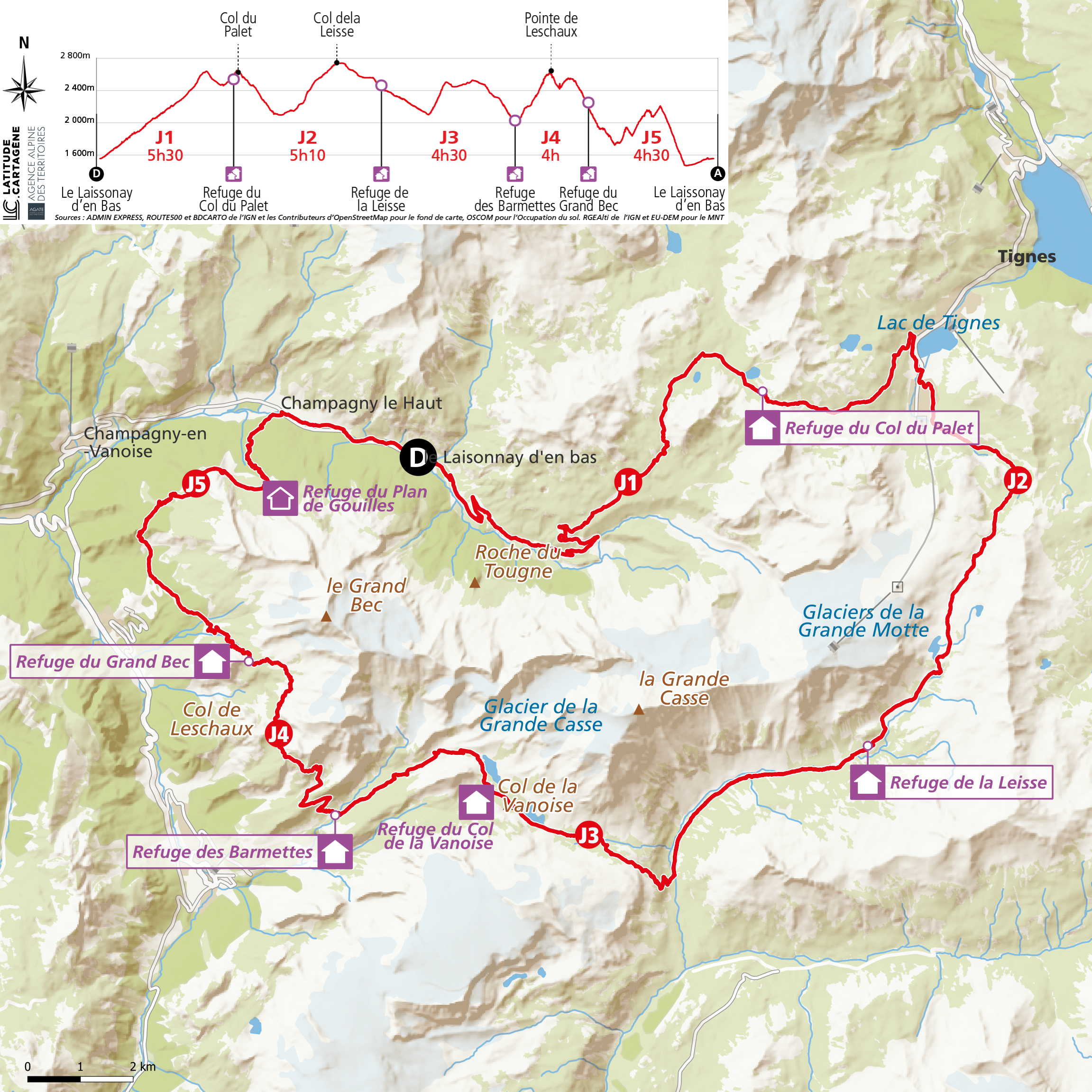
Tour de la Grande Casse – 5-day walking tour
This multi-day hike crosses a wide variety of landscapes: alpine meadows, peaceful trails, high-altitude lakes, glaciers, and steep ridges.
Please note that the starting point is the Laisonnay-d’en-Bas parking lot located in Champagny-en-Vanoise!
The first day is an immersion in this high mountain landscape.
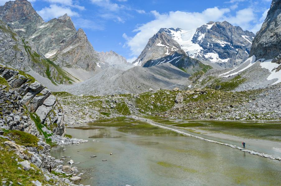
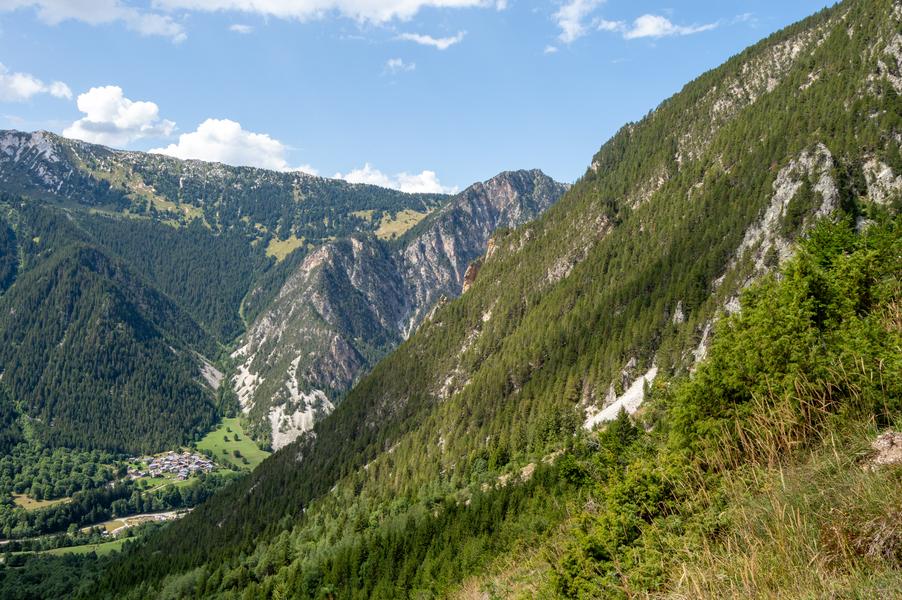
Starting from the Laisonnay parking area, the route crosses the village of the same name, considered one of the oldest and most isolated in the Haute-Tarentaise region. The hike then follows the Glacier Trail, which runs alongside rushing streams and crosses vast alpine pastures to the dried-up Glière Lake. Throughout the route, interpretive panels provide a better understanding of the glacial landscape, which stretches from the Grand Bec (3398 m) to the Grande Motte (3653 m).
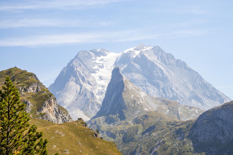
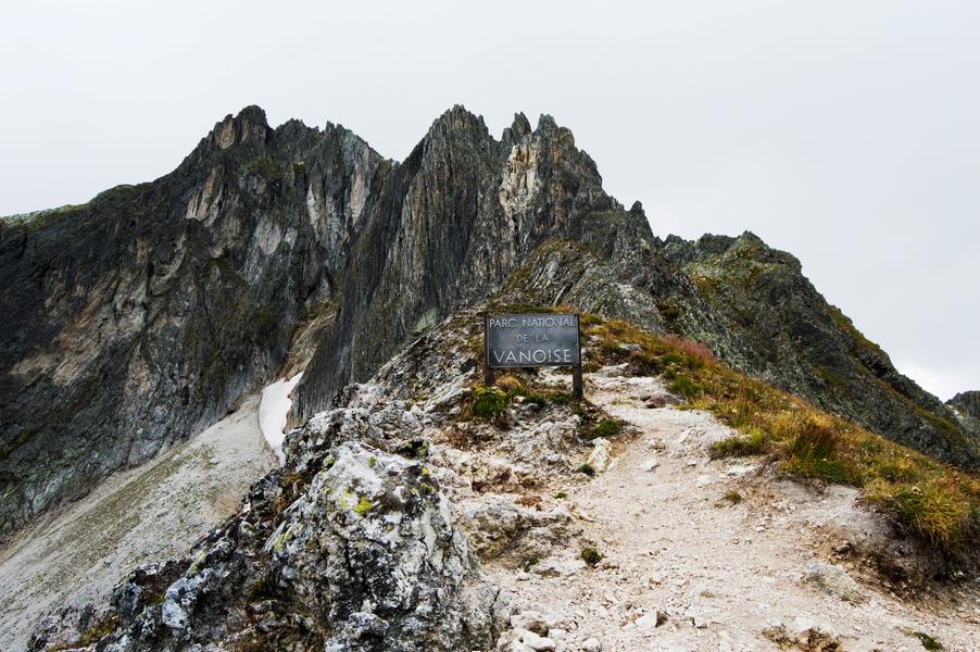
On the second day, crossing the Col du Palet marks the entrance into the protected area of the Vanoise National Park. The view of the north face of the Grande Casse is spectacular, with its hanging glacier. The highest point of the massif (3,855 m), this impressive 900 m wall is composed of limestone from ancient marine deposits. Nearby, the summit of the Grande Motte and the Aiguille de l’Épena are also visible.
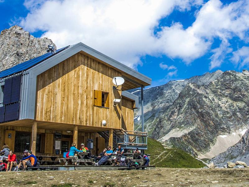
Further on, the Refuge de la Leisse consists of three wooden chalets built from 1970 onwards on a glacial moraine, at an altitude of 2,500 m. Located below the Grande Motte glacier, the site offers a wild and starkly mineral landscape.
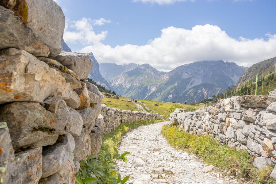
On the third day, the route leads to the Col de la Vanoise, an iconic pass in the Vanoise massif and the Vanoise National Park. Once used by muleteers and merchant caravans linking France and Italy, this trail is now reserved for hikers. The ascent follows the Leisse stream through the vast alpine pastures of the valley. Throughout the hike, the Grande Casse, the highest peak in Savoie, dominates the landscape. The pass also retains traces of its commercial and military past, as evidenced by a few remaining bunkers.
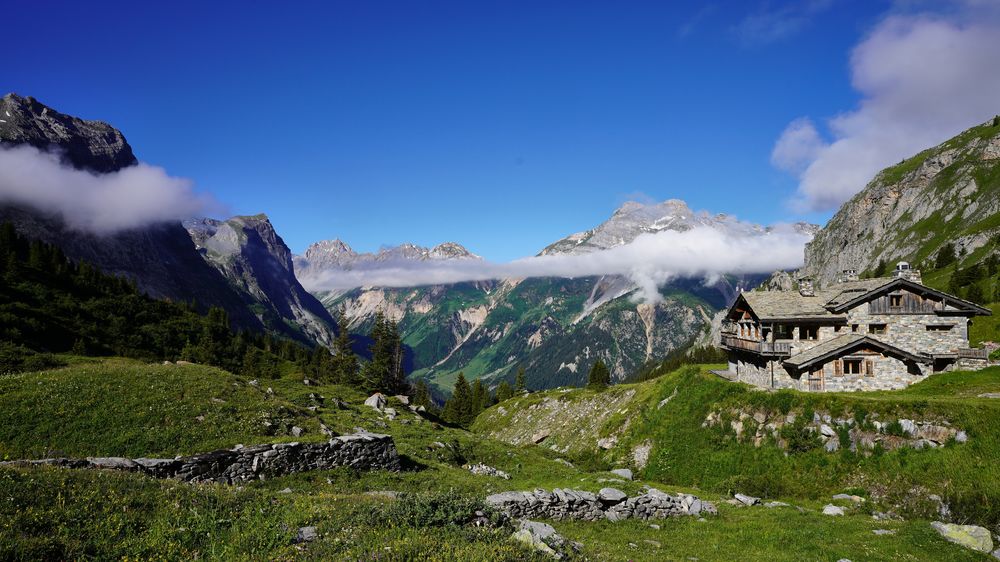
The penultimate day offers the possibility of encounters with alpine wildlife. This stage requires some effort but rewards you with magnificent panoramas. The trail crosses a more secluded area of the Vanoise massif and leads to the Grand Bec refuge, nestled at the foot of the Pointe de la Vuzelle.
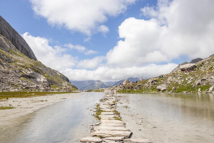
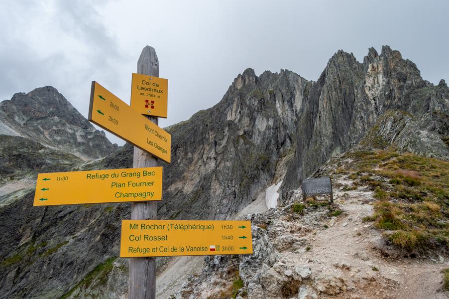
For a more alpine variation, it is possible to extend the route to Lac des Vaches and then reach the Col de Leschaux via the Col Rosset and the Col Noir. These three successive passes offer remarkable views of the massif.
For this final stage, the route approaches the foot of the Grand Bec (3398 m) in a peaceful, mountainous setting. The trail crosses a vast expanse of vegetation dotted with blueberry bushes. Amidst the conifers stands the Tour du Merle, a true natural landmark marking the entrance to the Champagny-le-Haut valley, where the clear waters of the Doron flow.
Guidebook with maps/step-by-step :
Start: Laisonnay-d’en-Bas parking area (1560 m)
Day 1: Laisonnay-d’en-Bas parking area (1560 m) – Col du Palet refuge (2587 m)
Duration: 5h30 / Elevation gain: 1191 m / Elevation loss: 170 m / Drive to the Laisonnay-d’en-Bas parking area. / From the parking area, follow the dirt track towards Laisonnay-d’en-Haut, then continue towards the Glière refuge. After passing the refuge, take the path that crosses the pastoral track several times. / Upon reaching the Plagne alpine pasture, approximately 600 meters past the Chalet du Sel, take the path that branches off to the right. / At the following junctions, turn first left, then right. The refuge is less than 300 meters away.
2/ DAY 2: Refuge du Col du Palet (2587 m) – Refuge de la Leisse (2487 m)
Duration: 5h10 / Elevation gain: 727m / Elevation loss: 814m / From the refuge, head to the Col du Palet, descend to Tignes Val Claret via the Chalet de Lognan. / Then join the GR55 which takes you to the Col de la Leisse, before following the signs to the refuge of the same name.
3/ DAY 3: Refuge de la Leisse (2487 m) – Refuge des Barmettes (2012 m)
Duration: 4h30 / Elevation gain: 484m / Elevation loss: 954m / Descend the valley following the GR55 towards Entre-Deux-Eaux. At the stone bridge at Croë-Vie, take the switchback path to the right. / Once on the plateau, ascend this last valley to the Col de la Vanoise, then continue for another 400m towards the refuge. / From the refuge, begin the descent and, via Lac des Vaches, spend the night at the Refuge des Barmettes. / For a shorter stage, or if there are no more beds available at the Refuge des Barmettes, you can stop at the Refuge du Col de la Vanoise.
DAY 4: Barmettes Refuge (2012 m) – Grand Bec Refuge (2405 m)
Duration: 4 hours / Elevation gain: 723 m / Elevation loss: 333 m / From the Barmettes Refuge, head northwest towards the Creux Noir cirque. / Once at the top of the Pralognan-la-Vanoise ski area, follow the trail markers to the Col de Leschaux on the left. Caution: this is a technical section reserved for experienced hikers. / At the pass, continue to the right towards the Grand Bec Refuge: the final descent and traverse, via the Col de Leschaux, to the Grand Bec Refuge.
5 / DAY 5: Grand Bec Refuge (2405 m) – Laisonnay Parking (1560 m)
Duration: 4h30 / Elevation gain: 696m / Elevation loss: 1520m / Leave the refuge towards the village of Plan Fournier. Begin by crossing a small pass at 100m, then descend into the valley towards the village. / At the first intersection, turn right. The path crosses a moor (low vegetation), then continue straight ahead through the Bois Blanc forest. The path is well-marked. / Upon reaching Plan Fournier, take the path on the right that climbs back up into the forest to reach a ridge that allows you to descend to the other side. / From the ridge, a short detour is necessary (150m): take a left onto a path to reach the base of the Tour du Merle rocks. / Go back down, at the first intersection, to return directly to Champagny-le-Haut and the Laisonnay parking lot, turn left at the intersection before the Chalets de Méribel, towards the Enclos du Seil.
Amenities
- > Car park
- > Covered picnic area
- > Orientation board
- > Picnic area
- > Public WC
Services
- > Accommodation
- > Coach access
- > Restaurant